The area around Dragash is rich in stunning natural beauty. It is the location of the Sharri Mountains with their beautiful landscapes and valleys and has lakes, large forests, cold springs, and rivers. The vegetation is still rich and varied and the region is rich in water resources.
Existing forest resource data in Dragash show important species of biodiversity of Pinus heldreichii (Bosnian pine) located in Koritnik. Other species of present trees are beech, oak, bush, fir, black pine. Forest productivity is good but can be improved if proper management can contribute to the local economy, employment, and biodiversity.
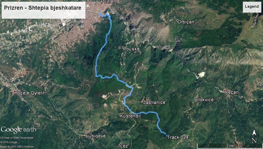
PRIZREN - MOUNTAINEER'S HOUSE
TRAIL START: 451 m altitude.
TRAIL END: 1282 m altitude.
TRAIL LENGTH: 12.7 Km.
TIME TO REACH DESTINATION: 4 hours.
COORDINATES OF STARTING POINT: 42° 12.569'N 20° 44.394'E
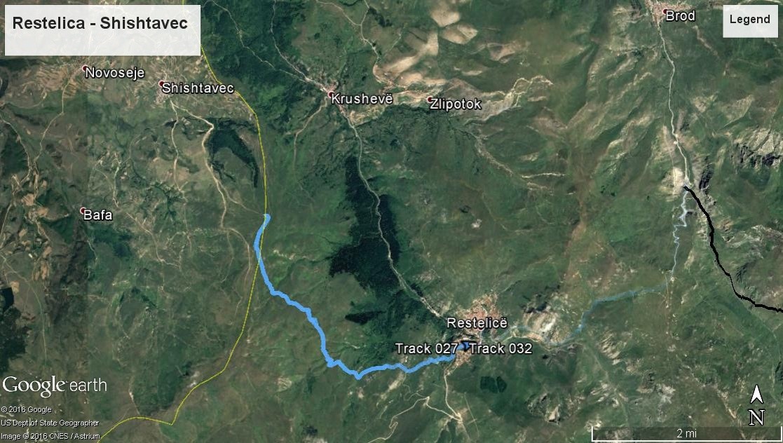
RESTELICA - SHISHTAVEC
TRAIL START: 1425 m altitude.
TRAIL END: 1770 m altitude.
TRAIL LENGTH: 7.6 Km.
COORDINATES OF STARTING POINT: 41° 56.476'N 20° 40.153'E
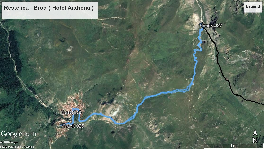
RESTELICA - BROD
If you travel by car you will need about 2 hours to reach Brod if you leave Restelica because of the mountains between them that force you to return to the town of Dragash. However, it is possible to follow the old hiking trails that connect these two towns and cross the amazing mountains at the same time. It is a moderate hike with good and clear trails, with wonderful alpine fields where you can see grazing horses and sheep.
TRAIL START: Restelica village on the eastern side (from here it allows you to climb less and enjoy hiking down to Brod). You can do this hike back, but you will need to climb up.
TRAIL END: Brod, or “Arxhena” hotel.
INITIAL ALTITUDE: Restelica - 1442 m.
HIGHEST POINT: 1972 m.
LENGTH: 9.2 km.
TIME NEEDED: 2-3 ½ hours in one direction.
DIFFICULTY: Moderate. There are some steep slopes and an area where the trail disappears, but not technically difficult areas.
COORDINATES OF STARTING POINT: 41° 56.450'N 20° 39.928'E
Trail Description
Enter the village from the main road until you reach a sharp U left turn. Continue on this road on the left up to the main part of the city. Continue the road to until you reach a right turn that leads you out of the village to the south and then into the river valley. From here the road goes along the river through the valley. After about 20 minutes you will encounter the smaller river flow into the larger river on the left. Here, follow the smaller river towards the valley up to the left. After about 100 meters the road will start on the left side of the river. Follow it up the river to the pass leading down to Brod. Up the road, you will find a spring where you can fill your bottles with water.
Before reaching the top of the pass, there is the shepherd's hut where a large number of Sharri dogs stay. Keep enough distance to be safe as Sharri dogs can be very territorial. Once you have gone beyond the pass, follow the mountains down to the left. There you will see a rock quarry from the distance and walk towards it. Then you will find the old trail to FYR Macedonia. At this point, you can either walk down the steep slope of the ski trail to Arxhena hotel if you are staying there, or continue following the old trail to the north that easily leads down to Brod village. Do not forget to look for the chamois living on the rocks in the vicinity of Arxhena hotel. They appear in the morning and late afternoon. A small restaurant called Ramce near the river (before arriving at hotel Arxhena in the direction coming from Brod) is a perfect place to relax and observe the chamois. Ask for binoculars from the owner. They also serve delicious lamb, so stop there when you return from hiking. Do not forget to call in advance because they need one hour to prepare the lamb properly (phone 029-285-119). They work only during the summer, but the landscape, cold drinks, chamois observation and fresh meat are something that should not be skipped.
STARTING FROM BROD: (I see that you have ignored my advice!) Just follow the instructions outlined above from the bottom. If you are leaving from Brod, it is best to turn right across the river right at the entrance of the town to start climbing the old trail to FYR Macedonia. If you leave hotel Arxhena you will have to hike up the ski slope, which is dusty, hot and very steep. Be careful not to follow the very damaged trail towards the icy lake in the south. Instead, after climbing to the level above the hotel, turn to the west and go high above the mountains where the road is narrower and made by the sheep. Do not worry too much about the road at this point, just go high above the mountain's pass and you will see where you need to go.
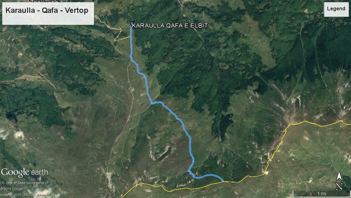
KARAULLA - QAFA - VËRTOP
TRAIL START: 1600 m altitude.
TRAIL END: 2100 m altitude.
TRAIL LENGTH: 8.7 Km.
COORDINATES OF STARTING POINT: 42° 07.264'N 20° 47.233'E
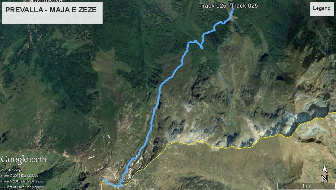
PREVALLË - MAJA E ZEZË
TRAIL START: 1527 m altitude.
TRAIL END: 2585 m altitude.
TRAIL LENGTH: 9 Km.
COORDINATES OF STARTING POINT: 42° 10.342'N 20° 57.773'E
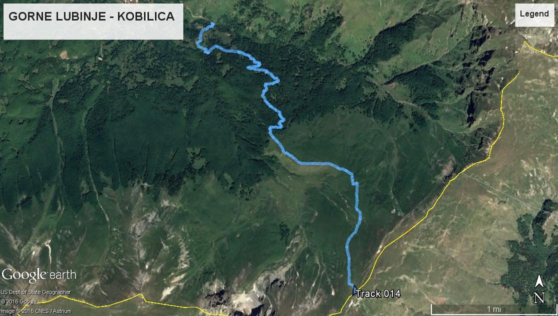
LUBINJE E EPËRME - KOBILICË
TRAIL START: 1527 m altitude.
TRAIL END: 2178 m altitude.
TRAIL LENGTH: 9.8 Km.
COORDINATES OF STARTING POINT: 42° 07.817'N 20° 52.299'E
KORITNIK
Koritnik, is one of the main mountains in the Dragash municipality, with the richest biodiversity, offering stunning views of the Sharr Mountains to the east and the Bjeshkët e Nemuna in Albania towards the west. The densely wooded mountain ends with a defined line of the border of growing trees where the alpine pastures filled with flowers in spring and mushrooms in the fall dominate. In the longest period of the year, you can find snow at the top. So, you have to get there prepared for cold weather.
TRAIL START/END: Old quarry behind Rapçë village.
INITIAL ALTITUDE: 1193 m.
HIGHEST POINT: 2395 m.
LENGTH: 15,00 km.
TIME NEEDED: 7-8 hours both ways.
DIFFICULTY: Moderate.
COORDINATES OF STARTING POINT: 42° 04.628'N 20° 36.115'E
This is a long walk, but the length helps ease the altitude to have to climb to reach the top. Except for the last hour, the whole hiking passes along an old mountain trail.
Trail Description
The starting point for this walk is a small quarry pass the village of Rapca. Once you arrive by car to Rapca take the left direction (ignore the first turn on the right after the separation in the center). Along the way, your view will open up and you will see the valley below. After about 1 km, there is an unpaved road that separates and continues to the right. Follow this path and you will see a small boulder right after turning right. Park the car here. If you are not with your car, then tell the driver to continue the road further.
This is the main unpaved road that you will follow until you reach the top of the mountain. About 15 minutes after you have passed the quarry you will encounter the #1 branch of the road. Turn right (left side leads you to a small village). After a while, you will enter the stump area and you will encounter branch #2; follow this to the right also. Continue to the woodcutters' road until you reach branch #3. You will encounter a green container to ensure you are in the right direction. Turn right after this road branch too. Continue to walk until you reach branch #4 and yes, you got it, turn right. This right turn ensures you that you reach the top and not across the border into Albania!
This was the last turn and you will follow this trail until you get out of the woods to the end. From there, follow the path along the ridgeline for about 1.5 hours until you reach the top of the mountain. In fact, there are two peaks, each with a pile of rocks. Sit, relax, enjoy the beautiful sights and gather strength before you go back following the same path as when you were climbing.
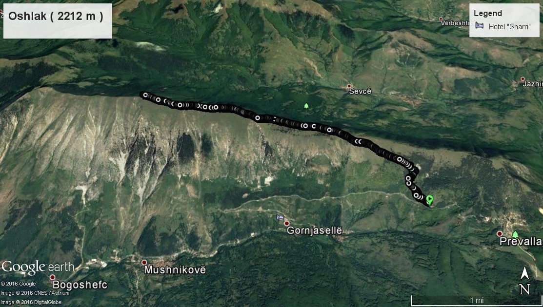
PREVALLË - OSHLAK
TRAIL START: 1453 m altitude.
TRAIL END: 2212 m altitude.
TRAIL LENGTH: 7.5 Km.
COORDINATES OF STARTING POINT: 42° 10.891'N 20° 56.942'E
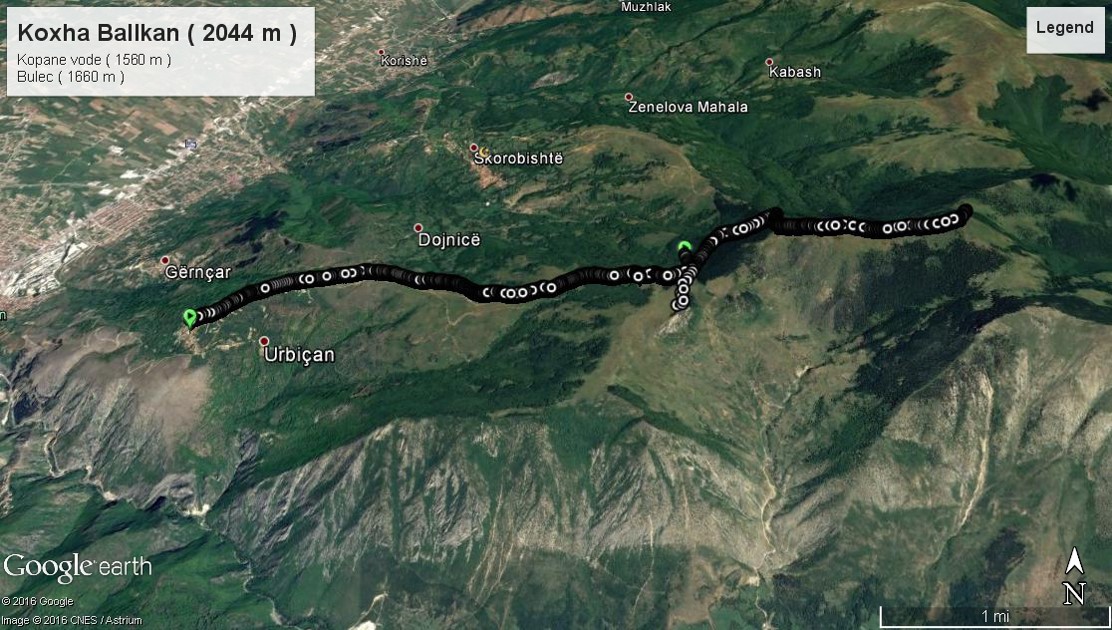
NOVOSELLË - KOXHA BALLKAN
TRAIL START: 961 m altitude.
TRAIL END: 2044 m altitude.
TRAIL LENGTH: 10.78 Km.
COORDINATES OF STARTING POINT: 42° 12.480'N 20° 46.696'E

